Projects
A collection of portfolio projects and blog posts
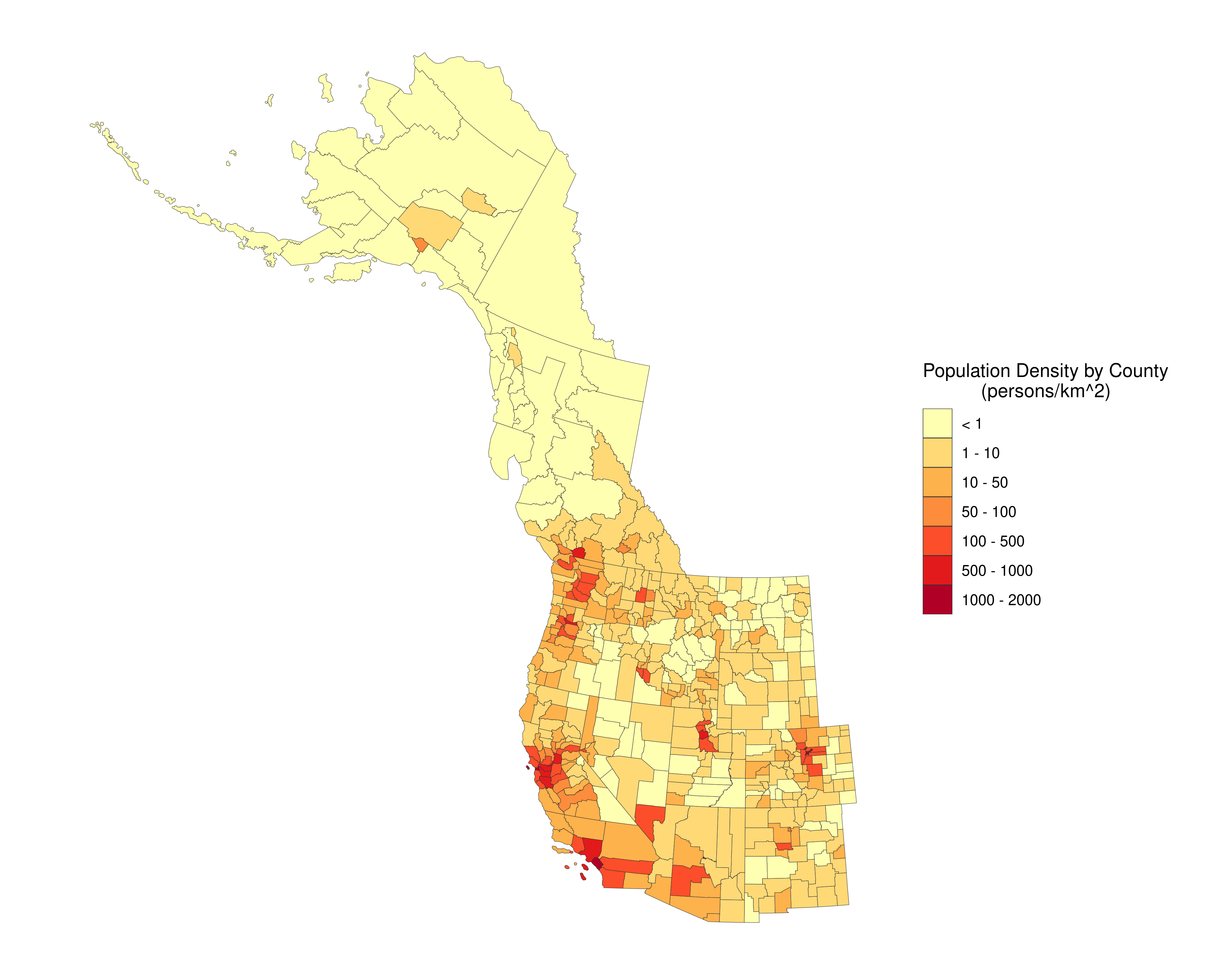
Mapping Population Density Across Western North America.
spatial analysis
R
Using open census data from the United States and Canadian governments, I created a population density map looking at number of people per square-kilometer in each county. For Canada, I used county equivalents (“census districts”) for the province of British Columbia.

Managing the Impacts of Environmental Education in Protected Areas
master's project
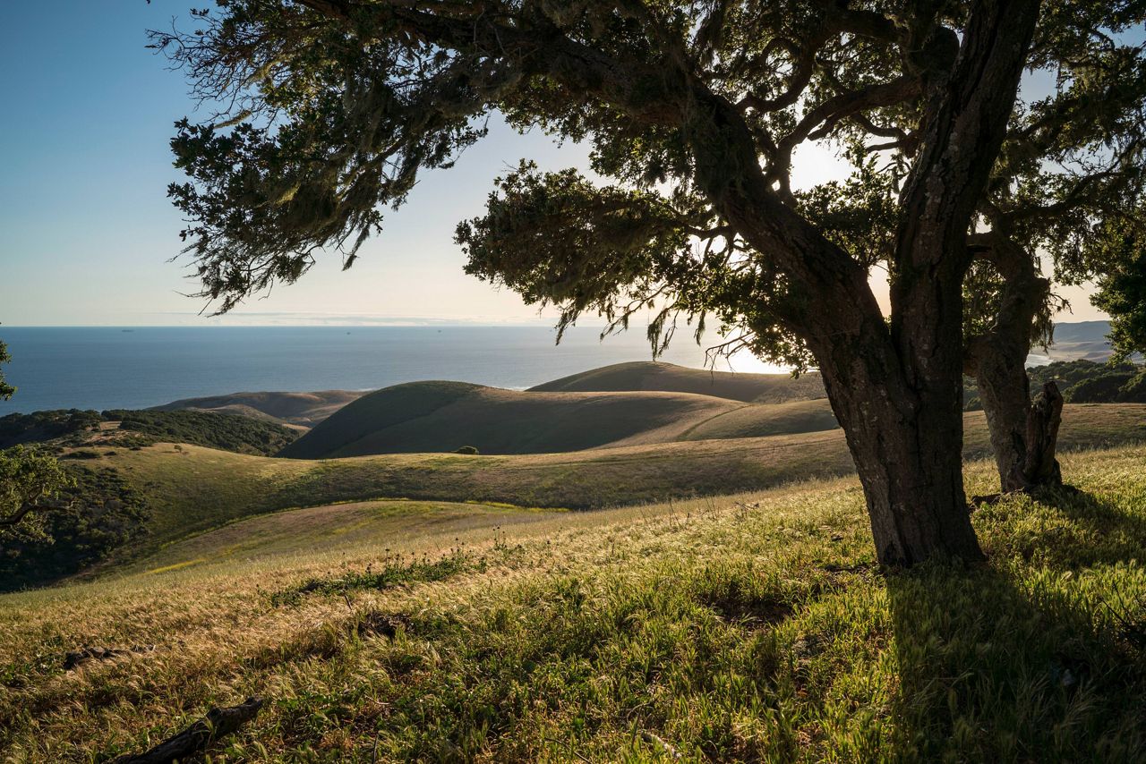
A semi-brief overview of my Master's Project detailing the impacts of environmental education in protected areas. Specifically, my project focused on the Dangermond Preserve in Central California, acquired by The Nature Conservancy in late 2017.
No matching items